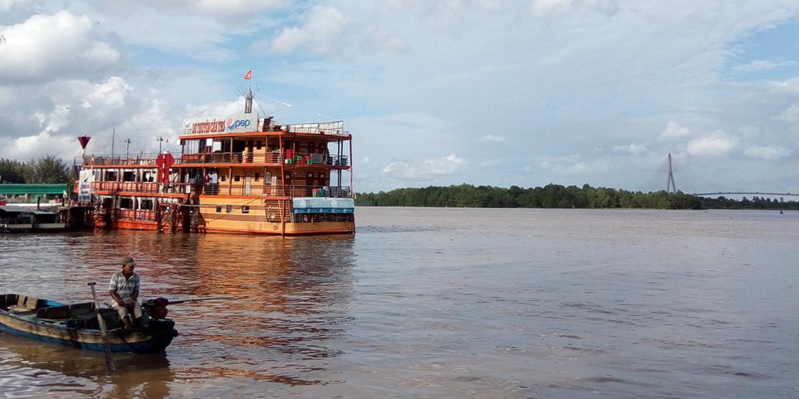
The Bassac/Hau supports the agricultural livelihoods of millions of people (and the global food system through intensive rice production), as well as fisheries, trade, and transportation. The human and non-human species who rely on this river are, however, threatened by threats such as global climate change and unsustainable development at the local and regional levels.
Rationale
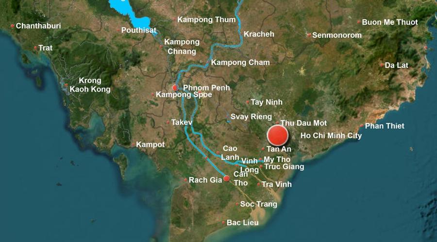
We are interested in the entire river (which flows 190 km from Cambodia through Vietnam to the South China Sea), but specifically in the stretch between the two largest cities on the river: Phnom Penh in Cambodia and Can Tho in Vietnam. Our interest in the Bassac / Hau river stems from the fact that, while it is often overlooked in discussions of the larger Mekong complex, it is of vast importance to diverse communities across Vietnam and Cambodia (including members of the Khmer, Vietnamese, Cham, and Chinese ethnic groups in both countries).
The disruption events experienced by the Bassac/Hau are numerous (and many have deep historical roots in pre-colonial and colonial manipulation and exploitation of the waterway). The primary events affecting the river today include the construction of upstream dams, dikes (in Vietnam) to allow for wet-season rice cropping, irrigation canals, sand-mining, and rapid urbanization of riverbanks and islands.
The broader significance of this case study lies in its relevance to other river delta systems, especially those undergoing rapid urbanization and intensive agricultural development. Regionally, we are interested in exploring the connections that link urban communities along the Mekong system, and the ways in which upstream development (of cities, intensive agriculture or aquaculture, or hydropower) affect downstream communities. 2.2 Are you or your team members presently working on the proposed case study area? Or has the case study area been the subject of previous study or action by others? We have extensive experience in the area. Dr. Gorman has conducted dissertation fieldwork in rural areas along the Bassac/Hau, while Dr. Ly has conducted his own dissertation research on urban flooding in Can Tho. Both Dr. Ly and Dr. Gorman have experience and connections in Cambodia that would allow for scaling up of the project. To our knowledge there has been no comprehensive study of the Bassac/Hau and the interconnected lives of its river cities, as we propose here.
We have extensive experience in the area. Dr. Gorman has conducted dissertation fieldwork in rural areas along the Bassac/Hau, while Dr. Ly has conducted his own dissertation research on urban flooding in Can Tho. Both Dr. Ly and Dr. Gorman have experience and connections in Cambodia that would allow for scaling up of the project. To our knowledge there has been no comprehensive study of the Bassac/Hau and the interconnected lives of its river cities, as we propose here.
Strategy
Our revitalization aim is to bring greater knowledge of the local connections between environmental and human systems (the Bassac/Hau and the human communities that it sustains) as well as the connections or tele-couplings that link the fortunes of distant river-cities to each other. The overall goal of the project is to elevate the voices of river-dependent communities (such as fishers and farmers) and their livelihoods, and to make sure that the interests and vital needs of these communities, as well as the vitality of the river itself, are taken into greater concern by urban planners in both countries. Real estate development (for the domestic luxury market and international tourism) is a real threat to the river in both areas -- our aim is to foster greater concern among policymakers for the long-term sustainability and health of the river, and thus the diverse communities that it supports. 5.2 What are your team’s transformational resilience and “justice” goals? How does your team define these concepts in the context of your case? (300 words max): For this project, we define "justice" in a diverse and complementary set of ways, such as the equitable use of the river and its resources (for fishing, agriculture, and power generation) between upstream and downstream communities; the protection of river-based livelihoods, such as fishing and farming, and the communities that they sustain; amelioration of vulnerability to river-related hazards such as flooding and erosion; and respectful treatment of the various cultural, religious, and historical sites of the diverse communities along the river. 5.3 What are the various steps necessary to achieve your revitalization goals? We anticipate that our revitalization goals will necessitate approximately 12 months of participatory and secondary research along the river and the cities it supports. This will be followed by another period of 6-12 months in which we construct interactive StoryMaps (with consultation from research participants), ensure that all materials are translated into relevant languages (including Khmer, Vietnamese, English) and then publicize and disseminate these outputs to relevant stakeholders and policymakers. One possible way to achieve these goals is to organize workshops or official events in both Can Tho and Phnom Penh in which the story maps are unveiled and local community members have the opportunity to share their experiences and vision with relevant authorities, representatives of international donors, and academics.
Methods
We aim to use ArcGIS Story Maps (an interactive tool hosted by ESRI) or an open-source alternative to create interactive multimedia histories of the Bassac/Hau and its river cities, Can Tho and Phnom Penh. This tool will allow us to embed video (such as oral history interviews), audio (music, voice, and field recordings), and images (our own and archival) within an interactive map or maps. Additionally, we will use historical remote sensing data (including satellite and aerial imagery from the Vietnam War era) to visualize changes in the river and settlement patterns over time. This story map will be supplemented by "traditional" scholarly outputs such as an edited volume or special issue of a journal, focusing specifically on the Bassac/Hau and its river cities.
How will your team map the river city in your project? Mention existing maps (historical or contemporary) and sources and proposed techniques to map non-spatial variables in your case study area (300 words max) : We will use historical and current remote sensing data to map the changing relationship between the Bassac/Hau and its river cities. This will include the georeferencing of maps produced during the French colonial period, as well as maps and imagery produced by the US military during the Vietnam conflict. This historical mapping using secondary sources will be complemented by participatory maps produced by members of riverine communities in Cambodia and Vietnam. These maps will be used to visualize community members' recollection of change in physical environment, ecology, and human settlement patterns over time, as well as their visions for the future.