Mahmoudaya canal has been neglected due to the trade movement, which stooped in the fifties of the last century. Historically, the area was a mix of bourgeois and workers adjacent to the industrial part. The Nile front had palaces surrounded by agricultural fields. The palaces’ owners also owned factories on both sides of the canal; next to the factories were the workers’ homes.
Rationale
After the nationalization, the area lost its luster, and its back was turned into slums adjacent to the industrial area; the Nile front maintained itself for a while. Consequently, there was water and environmental pollution. However, its Ecosystem was working well because of the linkage between the canal’s two sides by a primitive ferryboat which was very affordable in 2000. Dwellers reported many pollution issues, especially from the Nile Plants, which collect insects and mice. Moreover, there was a high crime rate and found bodies on the Nile.
In 2000, the government took care of the adverse effects on the area. It began to clean it and line the canal sides with the development of the Corniche. Two years ago, a decision was taken to fill the canal part inside the city and divert the waterway to a 5-lane highway in each direction. In the middle of them is a bridge, and to do this, they were taken from 25 to 30 meters from each side. Unfortunately, heritage buildings, factories, farms, and nurseries were demolished.
The study of this scheme was started in 2005, with street work on both sides of the canal. Still, the intangible heritage in the area connected to the waterway was erased and leading to the isolation of the two sides and planning problems such as unclear entrances and exits to the site.
It is being promoted, and people are encouraged to walk, and all aspects of it are a result of a wrong decision that was made.
Strategy
Since Alexandria lacks a sense of walkability and connectivity within its urban environment, the Mahmoudiyah axis will present a once-in-a-lifetime opportunity for the city to generate a green waterfront corridor in the heart of Alexandria, combining history, urban, culture, and nature. The revitalization approach will set an example of shifting the planning priorities from vehicle-oriented cities to a sustainable paradigm that favors the historical value and its adaptability to the modern end-user needs, resulting in a more people-friendly environment in Alexandria and an improved quality of life. The main driving essence of the revitalization will be ‘’space creation’’, a place where residents and tourists could enjoy the liveliness of Alexandria’s cultural landscape. Climate change adaptation, environmental quality, and water management will be key components of the revitalization goals. This will be through an emphasis on the denaturalization of the water body to reduce the urban heat effect and improve the urban vegetation cover, the rainfall management and storage, and improvements in the water quality for the citizens of Alexandria.
In the longer run, the Mahmoudiyah axis can result in the connectivity of the central historic nodes and districts of Alexandria by implementing a new integrated network of public water transportation, pedestrians, and cyclist routes.
Methods
Since the status quo is different from previous maps, the team will be guided through these maps to understand the previous situation. Moreover, the team will remap the area with two parallel approaches. On the one hand, a top-down approach through GIS mapping, and on the other hand, a bottom-up approach which is counter-mapping.
Counter mapping is creating maps that challenge "dominant power structures, to further seemingly progressive goals".counter-mapping is used in multiple disciplines to reclaim understudied territories. Counter-maps may reinforce and extend different stakeholders to draw their boundaries. The term itself is relatively new, and it came into use in the United States when Nancy Peluso used it in 1995 to describe the commissioning of maps by forest users in Kalimantan, Indonesia, to contest government maps of forest areas that undermined indigenous interests. The resultant counter-hegemonic maps strengthen forest users' resource claims.
Worldwide Examples of counter-mapping include attempts to restrict and protect traditional territories, community mapping, public participation in geographic information systems, and mapping by a relatively weak state to counter the resource claims of a more necessary condition.
Potentials for counter-mapping efforts can benefit different stakeholders, especially the most vulnerable, minorities, and poor groups. From this perspective, counter-mapping is a tool of alternative-critical cartography to uncover the overlooked aspects of a studied site.
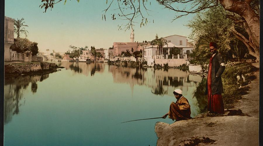
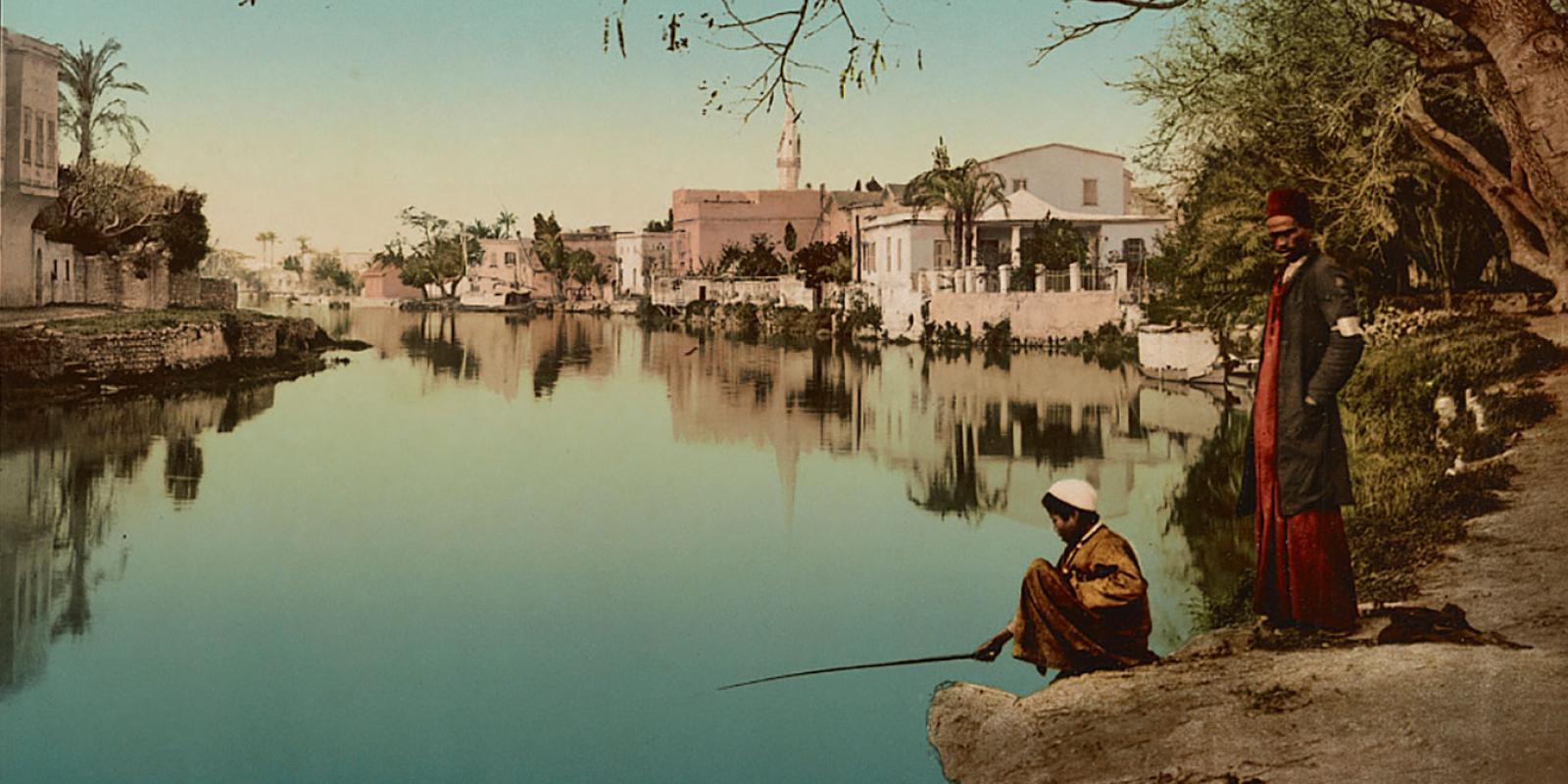
1890; Alexandria, Egypt. The Mahmoudiyah Canal. Source: Library of Congress.