From October to November 2021, the heavy rainy season has caused flooding in Sintang. The city and its surroundings were severely submerged in its worst flood in 58 years. Among more than 112,000 people affected and displaced. The main cause of flooding in the area is massive deforestation or logging. In the period 2001-2020, West Kalimantan lost 1.2 million hectares of forest. Deforestation does not stop, because the government does not fully implement the forest and peatland moratorium.
Rationale
Although flooding is a ubiquitous phenomenon due to global climate change, it is important for every river city to understand flooding contextually, by examining human and nature relationships which are deeply rooted in local culture and settings. We propose a "dendritic urbanism" approach, which is a way of looking at urban areas as an inseparable part of the river network, not only in hydrological and technical aspects, but also socially, economically and politically. This approach is actually rooted in the history of settlements in Kalimantan which have a strong character as river-based settlements.
Strategy
Instead of providing practical, short-term solutions, we basically want to find a new way of understanding "river cities", which are actually rooted in local history. Some of the underlying considerations are as follows: “riverfront city” is a universal urban planning/design issue in many cities of the world. Recent studies on the topic of urban waterfront in various parts of the world, both North and Global South cities, highlight various problems in waterfront planning and design. In Southeast Asia alone, where more than 70 percent of the area is water, studies that try to focus on water as an important element for understanding Southeast Asian societies and cities are still very limited. So we think that it is important for us to questioning and then understanding the concept of "river cities" based on exploring the relationship between cities and rivers in different contexts and locations, both in historical and contemporary dimensions.
Methods
- Mapping of the river bios, based on various ways and sources, such as storytelling, photo essays, sketches and drawings, video clips, etc.
- Identifying the tangible and intangible variables of the area. Tangible include the neighborhoods, the river, buildings, biodiversity, water, products, etc. While the intangibles include social structure, power relations, belief systems, memories, personal histories, values, etc.
- Building/ Structuring the knowledge: synthesis. Synthesis refers to the process of making connections and understanding the interdependence between elements.
- Recommendations. The previous steps are expected to reveal the cultural ecology of the Sintang city, such as how the community interacts with the river and the environment in a broader sense, which affects how they create dwelling places, livelihood, products, networks, ways of thinking etc. This undertanding of relationships and interdependence are particularly important when planning for sustainable and ecological ways of managing the urban development.
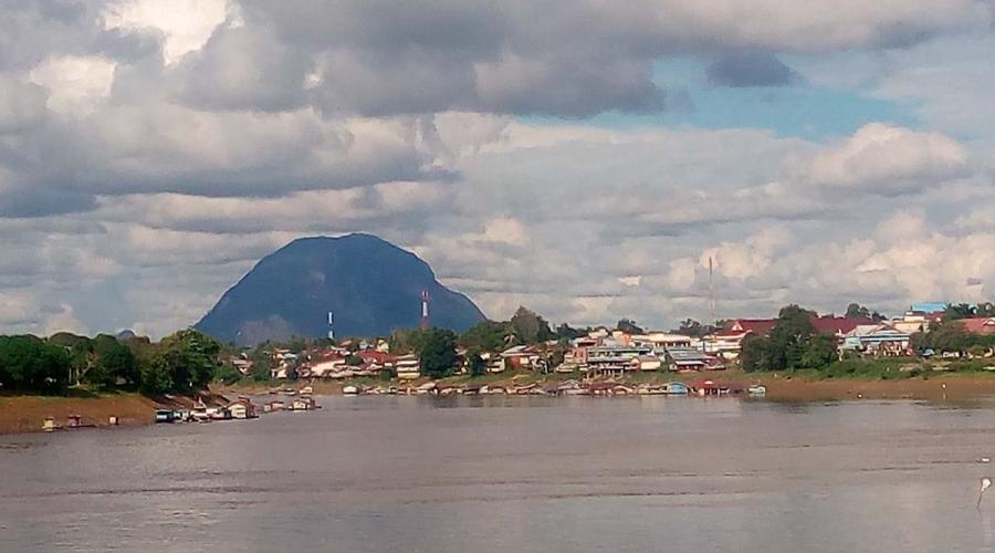
View of Sintang City and Kapuas River
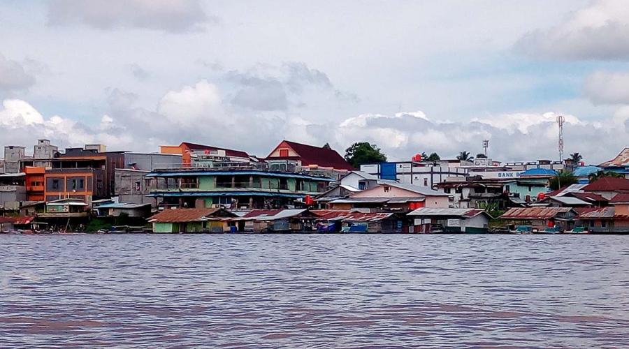
Sintang commercial center that close to the Kapuas riverbank
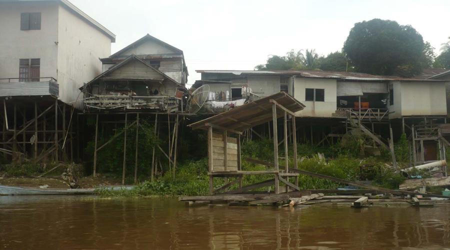
Stilt-houses
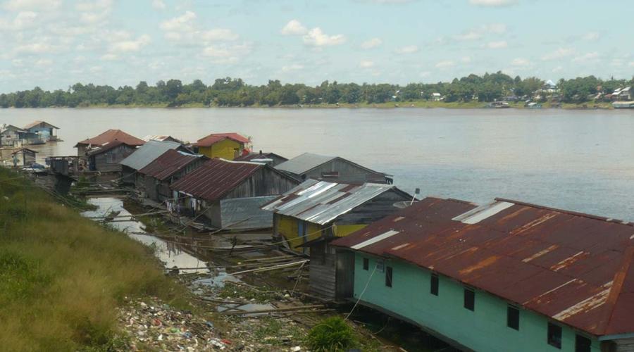
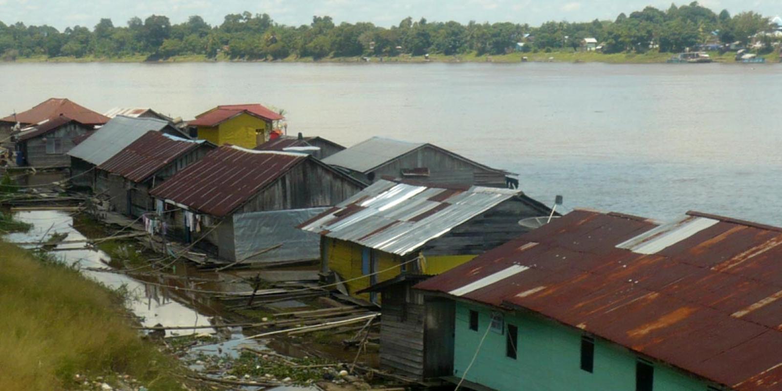
Raft/floating houses
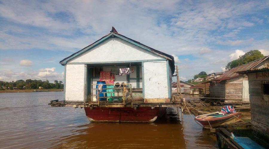
The houseboat