Bahmanshir Riverfront Regeneration
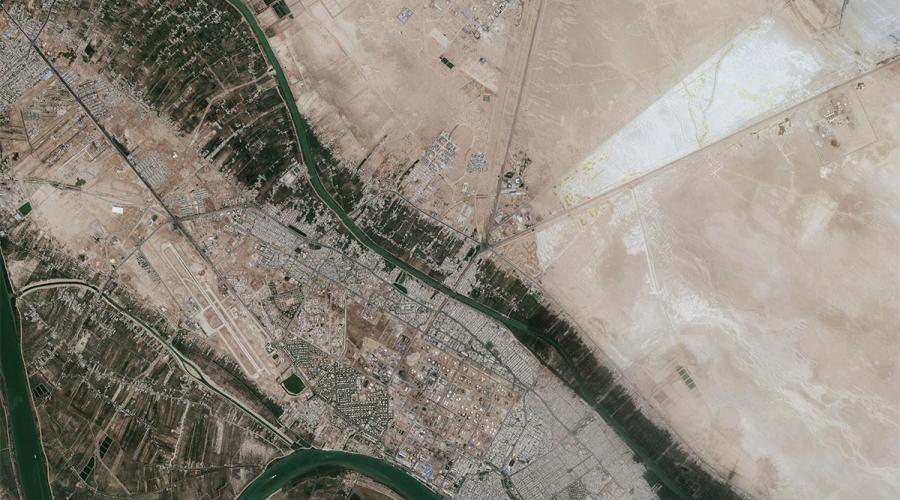
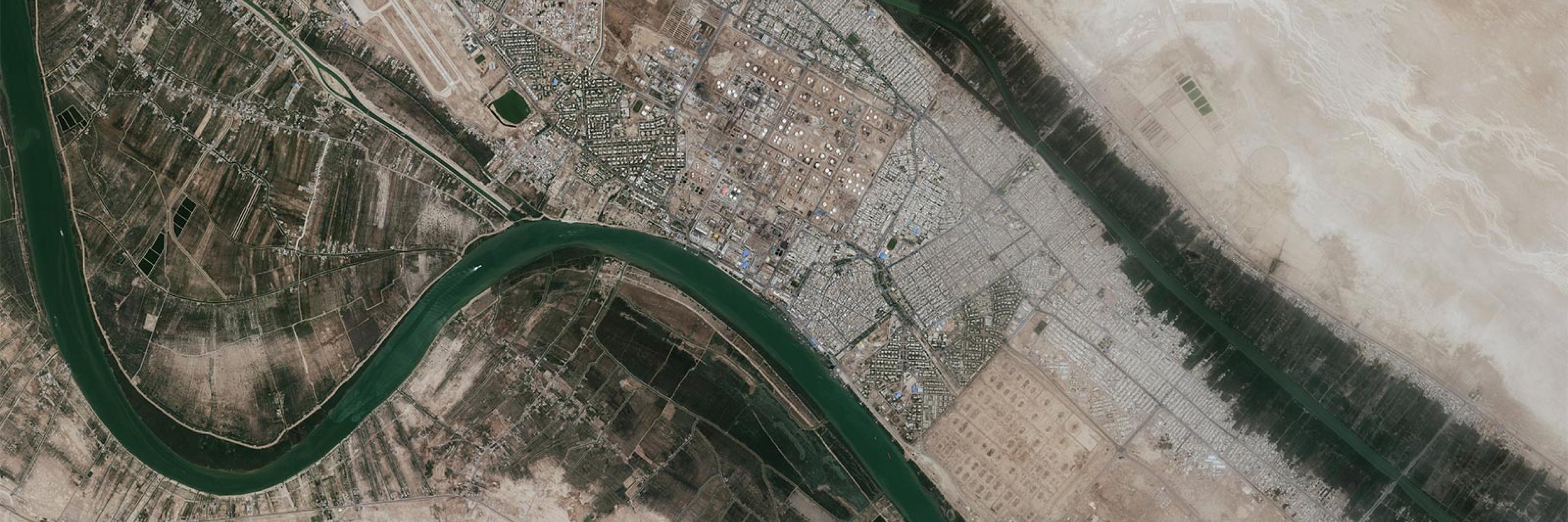
Bahmanshir goes across the Abadan city while its head is in the Khorramshahr. Both cities are suffering from the accumulation of colorful challenges. From the single-product economy (oil industry), the Iran-Iraq war, and global sanctions to global warming, drought-flooding, and covid effects.
Rationale
The rurban stretch on both sides of the Bahmanshir is the project's leading area for revitalization and riverfront regeneration. There are about 17 rurban boundaries that are dealing with multi-lateral malfunctions. While the rurban areas on both sides of the river are growing, they are neither identified as rural areas nor urban ones. Since they are ignored by the local government they are facing numerous problems like poverty, informal jobs, losing their green lands (Palm farms), push and pull effect and etc. These problems are wracking out the heritage landscape of the Bahmanshir. Bahmanshir is congested with the canals that irrigate and drain the lands that have made up a fertile region to establish a civilization over the centuries. it has the largest GBIs in the region and is a non-written ancient civilization. The river is one of the alive rarest plains rivers in Mesopotamia that is the main factor of the natural irrigation and drainage for peri-lands.
Strategy
- Providing the quantity and quality of water for all purposes (drinking, industry, agriculture, fishing, etc.)
- Protection of the environment and ecosystem of Behmanshir.
- Protection and restoration of palm farms, green spaces, and canals.
- Development of transportation infrastructure and access to the river basin and immediate environment of Bahmanshir.
- Revival of the traffic conditions of the vessels in the river.
- The economic development of the local community including the development of employment, entrepreneurial culture, and increasing the level of income (completion of the supply chain in the production and tourism sector, especially ecotourism in the practical and immediate environment)
- Providing the necessary conditions to attract investors (domestic/foreign).
- Development of institutions and organizations of non-governmental organizations and local associations in increasing and attracting the participation of the local community in achieving all goals.
- Development of sustainable security (social, political, economic, military, environmental, physical).
- Development of critical infrastructures (water, electricity, gas, wastewater, telecommunications, etc.) in the immediate vicinity of Bahmanshir.
- The development of spatial per capita is required to realize spatial justice and welfare in the immediate and operational environment of Bahmanshir.
- Providing good quality urban and rural services and increasing the level of control and implementation of construction-related laws to increase the quality of construction in immediate areas in urban and rural areas.
Methods
The future-studies methodology was chosen to evaluate and planning due to the area's extreme chaos and uncertainty. For this, we used the six-phase Haines model (framing, scanning, forecasting, vision, planning, and acting).
At first, we specified the project's domain, evaluated the project, and designed the project's pathway. The most influential indicators were selected for scanning. Any future research is the product of interactions between several components, and any event involving a complex system with interdependent variables has been exposed to cross-effect analysis (CIA).
C.I.A. reduces complexity. We used MICMAC. The map of indicator typology, the network of indicator interrelationships, and identifying the driving forces (DF) were the outcomes of MICMAC.
In the third step, uncertainties were described for any DFs. Combining futures types with the Cross-Impact Balance (C.I.B.). The task was completed via the scenario wizard program. The scenario wizard aggregated the 1170 judgment cells and analyzed different situations to determine the most adaptable scenario. The way of the landscape is the most adaptive scenario. Plans were then drafted in accordance with the nature of the local character of the land and communities, and action plans were created to drive the regeneration plan of the Bahmanshir riverfront areas.