The canals of Padova: from a forgotten monument to a living socio-ecological system
This project focuses on the Bacchiglione river in its stretch upstream and downstream the City of Padua and on the ancient canals it feeds in that area, such as Tronco Maestro, Piovego, Alicorno, San Michele/Naviglio Interno, Santa Chiara, San Massimo, Roncajette, Fossa Bastioni, Scaricatore, San Gregorio, and Battaglia Canals. Several of these canals are hundreds of years old and run through the historical centre of Padua, often bordering the city walls built in the Middle Ages or during the Reinassance by the Serenissima Republic of Venice, or connect Padua to the town of Battaglia Terme.
Rationale
This watercourse system is a waterscape of historical, monumental, recreational and ecological value which can be considered to be disrupted due to multiple acute and chronic events: culverted or dried up canals over the past 150 years; water quality degradation to due urban emissions (combined sewer overflows, untreated discharges) and upstream agricultural inputs; sectorial water management prioritizing flood risk reduction and irrigation with not enough care for water quality and biodiversity, an issue becoming even more urgent in a time of climate change which is bringing for example more heat waves and water scarcity; excessive proliferation of aquatic vegetation which promotes siltation, with both factors impairing navigation and representing a flood risk factor; potential sediment pollution due to past industrial activities complicating future dredging activities; weed vegetation proliferation and littering along the canals which degrade the waterscape and promote a negative perception in local people thus distancing them from watercourses in a negative feedback cycle (less use means less invested resources to manage the river); lack of regular watercourse maintenance (which is a slow-creeping disruption event connected to many of the above issues) and no shared criteria to manage vegetation multifunctionally along urban canals.
Strategy
We focus on this watercourse system because it is extremely complex, and there is a need for an integrated management approach that accounts for this complexity and the multiple benefits which can potentially be generated. An integrated management approach should safeguard this historical waterscape while making it ‘alive’ and delivering benefits to biodiversity, the city inhabitants and local businesses. Also, Padua is one of the wealthiest cities in northern Italy, home to numerous industries and to one of the most important universities of Italy, with many students. Showcasing an example of sustainable and integrated river management and restoration here has an incredible communication value.
Our goals more in detail:
1) improving the knowledge base on the functioning of the river-city system, in terms of hydraulics, water quality, biodiversity and ecology, public perception, ongoing and potential river-related businesses, stakeholder priorities. The benefits provided locally by a more integrated watercourse management will also be assessed;
2) creating new modes of communication on the multiple values of historical waterscapes, combining the heritage of fine arts, literature and historical cartography with information on biodiversity and ecosystem services provision, and involving local communities and stakeholders;
3) setting up, through a gradual participatory process, a technical board meeting periodically to discuss the abovementioned disruption events in terms of knowledge base and integrative solutions. The board will involve key public and private actors regarding the management of the watercourse system;
4) definition of guidelines to implement a more integrated and participatory management of the watercourse system, with multifunctional focus (flood risk reduction, water quality, ecosystem services provision including local jobs and businesses, biodiversity restoration, recreation, navigation, recovery and revitalisation of cultural heritage water infrastructures and waterscapes, etc.);
5) definition of short, medium, and long-term actions and funding sources to implement what mentiond above.
An important cross-cutting goal will be public engagement, through dedicated participatory and communication efforts. Another one is the redefinition of the ecosystem services approach to improve the management of waterfront cultural heritage and the sustainable regeneration of physical assets of the canals.
Methods
A selected number of researchers and other actors from different disciplines (geography, history, art history, economy, anthropology, ecology, hydraulics) will collaborate to refine a strategic methodological approach to tell the story of this complex waterscape, map its current multifaceted features, provide relevant information for management, and promote revitalization.
To tell the story of Padua as a ‘river city’ we will follow a geo-historical approach, examining the environmental and historical evolution of the case study. Non-material culture will also be considered through an anthropological perspective, to focus on how waterscape perceptions have changed over time and why this heritage is endangered today. Written and digital format will seek to combine historical and design research components, to generate an interdisciplinary approach to data generation and analysis that reflects what could be termed as ‘participatory turn’ in arts & humanities research. The historical research component will include document retrieval and analysis, covering a range of media including art, print media, local histories and planning documents, and the collection of the oral histories of local people and those connected with the waterways.
Ecology and economics are disciplines not often associated with research on the cultural heritage of waterways; however, their contributions here is fundamental to explore the complexity and intrinsic multi-functionality of this hydrographic network. Information on river morphology, depth, flows and water quality will be mapped through field monitoring and integrated into predictive models to be used as decision support systems. Past monitoring data (1980s-1990s) will be digitized for comparison. Aquatic and river bank vegetation as well as litter presence and composition will be mapped through visual census. Fish fauna presence will be mapped exploiting fishers’ local ecological knowledge.
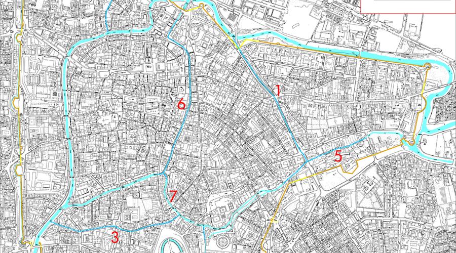
Current canals of Padova (light blue), and those which have disappeared from the sight either because they were dried up (1, 2, 3, 6) or culverted (4, 5, 8). Image courtesy of Comitato Mura di Padova.
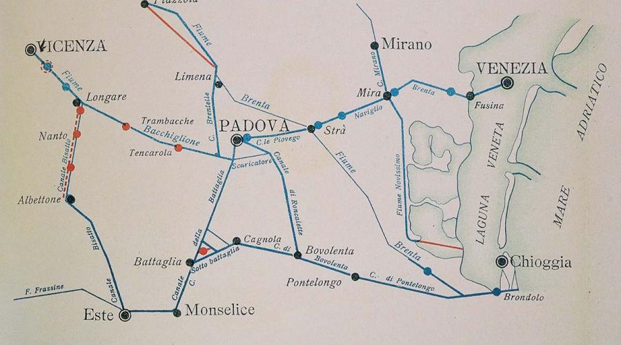
Nautical network in central Veneto between the 19th and 20th centuries. Since the Middle Age, Padua, as city-State, was the thriving hub of inland waterways. Peculiar freight boats allowed commercial relationships among Venice and the inland harbours up to the first decades of 20th century (in C. Grandis, F. Selmin, eds, Il Bacchiglione, Sommacampagna, Cierre, 2008, p. 249).
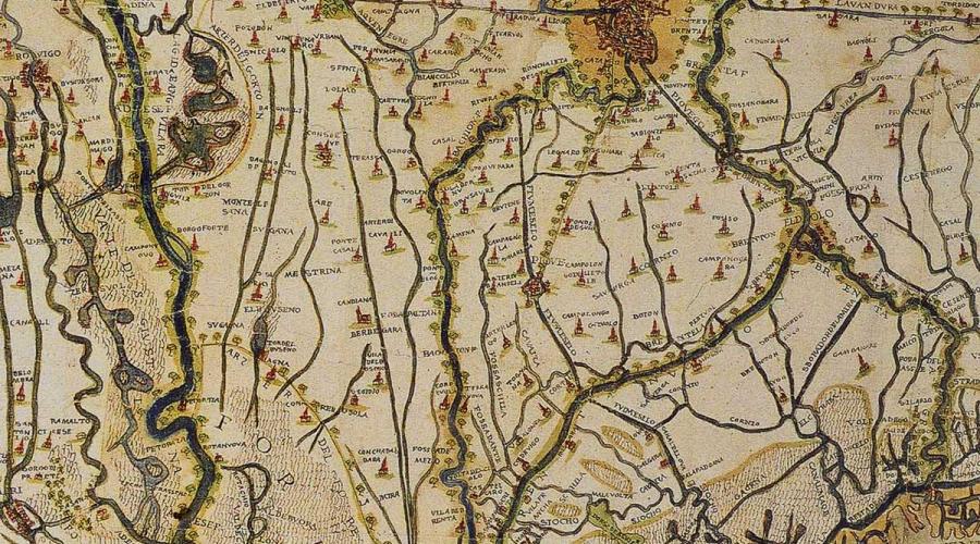
Portion of the low plain, southeast of Padua, from a handwritten map, drawn around the mid 16th century. The document depicts the hydrological context surrounding Padua, where artificial canals and natural flows were carefully managed by Venetian water engineers, like Cristoforo Sabbadino, the author of this map (Archivio di Stato di Venezia, SEA, Diversi, dis. 119).
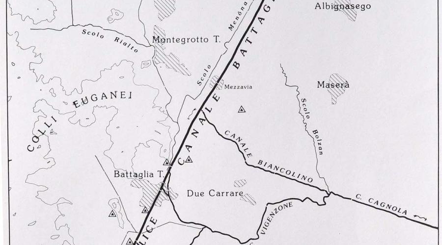
Hydrography of canale di Battaglia, in a drawning of Pier Giovanni Zanetti (P.G. Zanetti,ed., La Riviera Euganea, Padova,Programma, 1989, p. 30)
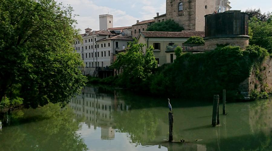
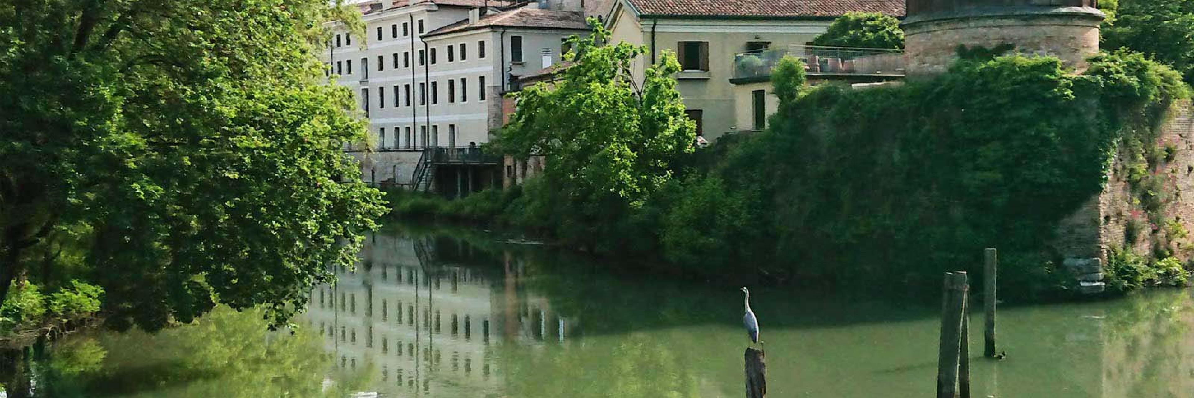
The San Michele canal departing from the Tronco Maestro canal in front of the ancient Specola tower, in the historical centre of the City of Padova (picture by Alberto Barausse)