Reviving the least developed Danube-adjacent region: The case of Vidin
The project focuses on the Danube’s westernmost stretch on the Bulgarian territory, a section outlining the border between Vidin Province and Romania. Given the broader impact of the Danube ecosystem, tight city-periphery functional dependences and socio-economic relations, our research focus area covers not only the city of Vidin itself but the whole province/region (NUTS3 region).
Rationale
The project focuses on the Danube’s westernmost stretch on the Bulgarian territory, a section outlining the border between Vidin Province and Romania. Given the broader impact of the Danube ecosystem, tight city-periphery functional dependences and socio-economic relations, our research focus area covers not only the city of Vidin itself but the whole province/region (NUTS3 region).
Despite the seemingly positive geographical prerequisites and the significant resources that Danube provides, Vidin is one of the least developed NUTS3 regions in the EU. It is characterised with very poor socio-economic indicators, low income and standard of living, steady trends of decreasing and aging population, growing immigration, depopulation, technological and infrastructural backwardness, and peripheralization.
The commissioning of New Europe Bridge in 2013, only the second bridge between Bulgaria and Romania along their 470 km river border, was widely expected to enhance the competitiveness of the regional economy. Yet the socio-economic situation remains largely unchanged.
Further studies about unused potentials and ongoing processes are critically needed to conceptualize a sound vison and strategy of how to embed all the development initiatives into a holistic resilience framework, provide further theoretical and practical inputs, deeper insight into the city-river nexus, and innovative tools to exploit potential synergies.
Strategy
The project aims to conceptualize a knowledge framework and a strategy of how to develop a holistic and scientifically sound regional development model, capable of mobilizing the endogenous potential of the city/region and strengthening its resilience. It will cover the following sub-tasks:
- Gaining deeper understanding of the issues through multidisciplinary studies and raising awareness
- Networking and building public-private-people partnerships as an informal network of diverse stakeholders
- Envisioning the future and offering solutions by designing sound Action Plan and crafting certain recommendations to the local and regional authorities
The utmost goal is helping the region build a developing, resilient, equitable, and inclusive society. That is related to deep understanding of the longer-term, structural, and multi-faceted nature of disruption and recovery, and taking into consideration and addressing the different systemic, chronic and gradual changes in the environment, economy and society. A holistic and well-grounded knowledge- and evidence-based approach should help the city/region find solutions to some of its most pressing problems and the cascading adverse effects they produce.
The network may rebuild the broken connections between science and practice and support stakeholders to track important trends, implement initiatives enhancing regional resilience, exploit territorial synergies, and excel in strategic foresight.
Methods
The scientific research (to be presented through articles, papers, etc.) will focus on: the important cultural and historical role of the Danube for the region; the advantages and disadvantages of Vidin’s geographical location and its proximity to two national borders; the changed geopolitical situation after the socialist period; the evolution of the idea for constructing a new bridge across Danube; the recent transformations and potential opportunities to improve the economic, social and ecological environment, etc.
Diverse historical and contemporary maps will be collected to visualize the different thematic components of the case-study: specifics of the geographical location; key natural characteristics; transport corridors and road networks; certain social and economic processes; freights along the Danube; areal coverage and target zones of some Danube-related strategies.
Then, the project team will design own maps and graphical representations to estimate the level of socio-economic development of the city/region in comparison to other cities/regions aiming to capture the chronological patterns and territorial aspects of the multi-layered inequalities/disparities. The study will uncover some key components and factors that can be drivers for transformation, and envision what are the most important revitalization objectives that should climb in the priority ladder and become part of the political agenda.
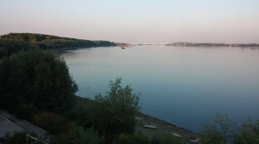
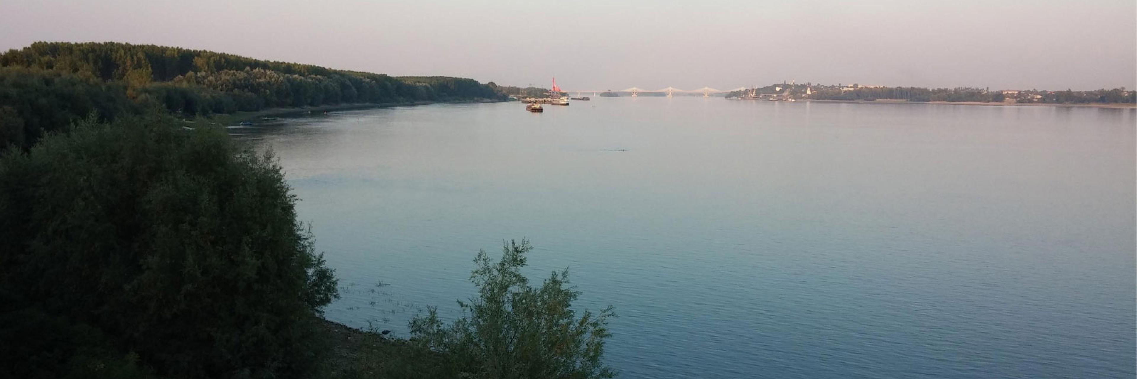
The Danube river as seen from Vidin
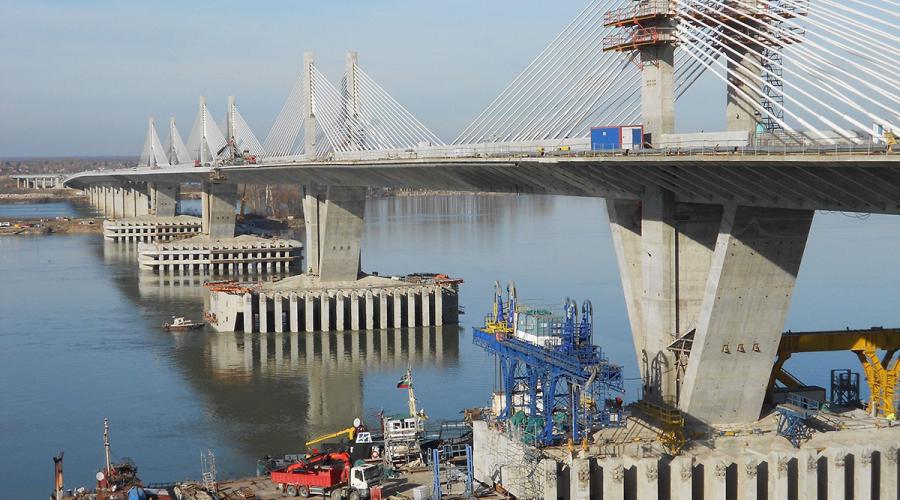
New Europe Bridge (kmeta.bg)
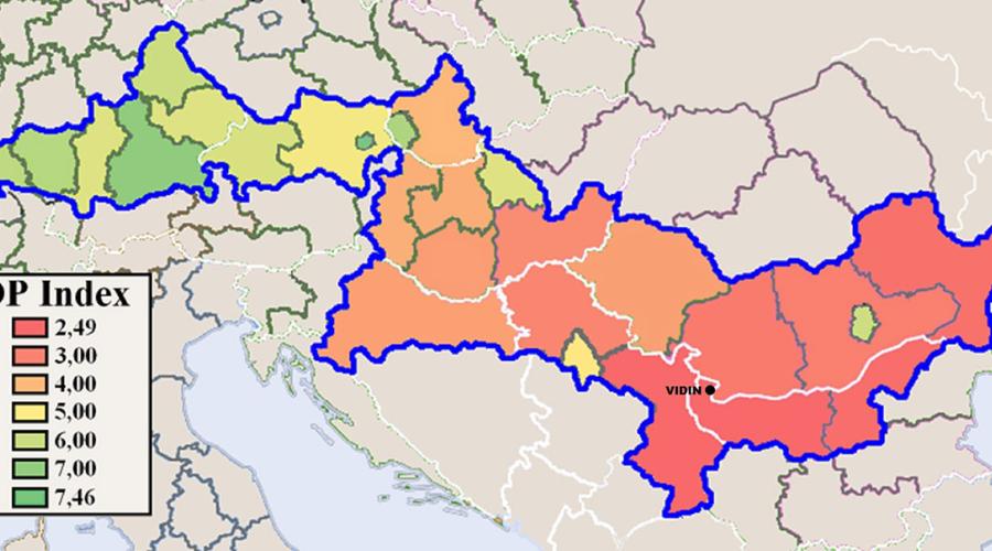
The Development & Prosperity Index for the Danube-adjacent NUTS2 regions