Shenzhen River Project
Hong Kong is a prime example of a city dealing with multiple challenges that emerge from being situated at the peri-urban interface. It is highly urbanised but also possesses significant ecology and history. Its aquatic environments, though highly impacted, are highly diverse and contain >25% of the species found in China even though it has been continuously developed for hundreds of years. As such, there is a need to find a balance between urban and rural communities and to: 1) bring traditional livelihoods and communities into the modern/urban landscape while safeguarding cultural and ecological capital; 2) identify specific remediation actions to enhance environmental quality and protect biodiversity. In particular, how traditional communities can be supported in transitioning into those which are comfortable with, and can actively contribute to, social and technical innovations.
Rationale
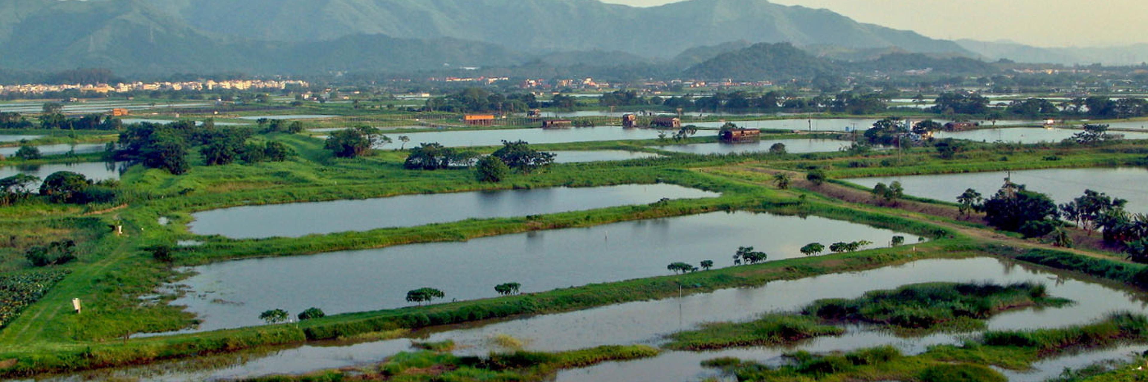
The main focus on the Shenzhen River and its links with Long Valley along the Sheung Yue River (inland) and Deep Bay (delta region), but it feeds into broader projects, which consider different aspects of the Pearl River Delta and development of the Greater Bay Area (southern China). This stretch of river has a range of different development pressures, protection levels, and attempts at mitigation. Upstream has traditionally been peri-urban agriculture which is now slated for urban development for housing as a “satellite city”. The lower river is characterised by complete urban and industrial development on the Chinese side of the border, but a mix of development, revitalisation, and even RAMSAR protection sites on the Hong Kong side of the border. A rapidly expanding population and the associated development is the largest issue facing the region and will form the focus of our study.
Development in the region manifests in several ways:
- Development in the Pearl River Delta: The Pearl River catchment has a population of >80 million people. The associated negative environmental externalities of development have caused extreme water pollution and sedimentation, resulting in environmental problems that have damaged local health and livelihoods across multiple sectors.
- Encroaching urbanisation: housing developments in northern Hong Kong threaten the remnant greenspace, posing risks to ecology and biodiversity. The region is particularly ecologically sensitive due to the presence of wetlands and a diversity of flora and fauna - including species classified as vulnerable or endangered. Yet, the social and cultural value of these areas is rarely considered in development plans.
- Continuing patterns of urban/international migration and the need for community revitalisation: Historical migration to more prosperous urban areas locally and overseas have resulted in the decline of peri-urban communities across Hong Kong. The industries that are considered the impetus of Hong Kong’s economic growth, which are prioritised by the government, are associated with urban areas (e.g., finance, technological development) reducing opportunities for economic development in peri-urban areas. Without concerted community revitalisation efforts, it is likely that migration from peri-urban areas will only increase in the future, further accelerating the loss of cultural and natural heritage.
As such, it is imperative to balance wider community needs for housing and development with local livelihood needs and ecological concerns.
Strategy
Despite Hong Kong having a small primary production (agriculture/aquaculture) sector, its extensive agricultural land coverage, physical environmental conditions, and production readiness have made it an ideal venue for incubating, experimenting and promoting eco- and climate-friendly innovations. The approaches developed here could come to form industry standards and provide templates for how to revitalise and safeguard ecological and social capital in the face of increasing urbanisation.
Our primary goal is the implementation of nature based solutions (NBS) and regenerative production innovations (RPI) to develop aquaculture and revitalisation strategies that work with nature and the local communities. This project will enhance the local biodiversity and ecosystem function while providing sustainable income and climate resilience for local communities.
Social innovations and social capital will be incubated through drawing upon the knowledge of local communities of interest and engaging relevant stakeholders. The engagement and incubation process will model after social innovation principles, including community co-creation, participation, and empowerment, aiming to create social values to the stakeholders and other community members.
We will engage with the oyster communities to restore oysters to the project site, then monitor the ecosystem services of biodiversity enhancement, water filtration, coastal protection and livelihood enhancement.
Relevant stakeholders such as scientists and environmental engineers, social entrepreneurs, existing fishpond operators and aquaculture practitioners, green group leaders, incubators in the markets, as well as impact investors will be engaged. Establishing meaningful collaborations between communities and relevant stakeholders geared towards sustainable production and community revitalisation, enabling resource and information exchange.
Ultimately, the social and ecological needs of communities along this river system need to be balanced. This includes facilitating the development of a satisfactory standard of living for communities that have historically not been prioritised for development. This can be achieved through the inclusion of communities in resource management decisions and the implementation of NBS and RPI to provide diversified income streams while safeguarding ecosystems and cultural heritage.
Methods
The river system’s story will be told through analysis of the policy landscape and urbanisation trends. The history of Deep Bay and PRD region will be mapped through a review of historical records and accounts. These records will also help inform history surrounding international border relations and how policies changed through time. Where possible oral histories from local communities in the area will also be collected and documented. In addition to this history, the policies and policy evolution regarding urban developments surrounding the rivers and greater region will be located from government records to map the urban and political history. Historical maps showing the change in the coastline, development, and changing environment of the Pearl River Delta region as well as environmental data, such as baseline biodiversity surveys and ongoing water quality monitoring will also be undertaken.
For social mapping, local communities will be engaged to determine important institutions and stakeholder networks that are used for resource management and governance. Participatory mapping will also be used to allow community members to identify their community’s current ecological and social challenges.